

Labor Day Severe Weather Potential In North Dakota
Some Drought Relief
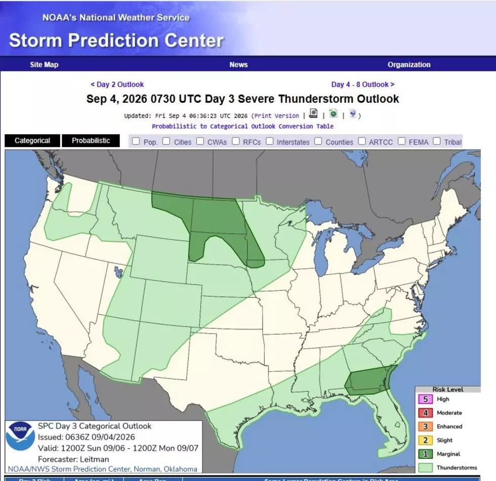
It could be a damp Labor Day across much of North Dakota. The potential for severe weather is possible over virtually all of the state on Sunday afternoon and evening, and lingering into Labor Day morning. Labor Day could bring widespread rain across North Dakota, which will be welcome news in our current drought situation. Here is the latest map from the Storm Prediction Center.
Primary Threats
We are in a Level 1 or a marginal threat for severe weather Sunday into Monday, so this is far from a certain threat. Even though the severe weather potential appears to be conditional if storms can develop, damaging winds and large hail will be possible with supercell thunderstorms.
(SEE ALSO: When Bismarck-Mandan could see its first snowfall)
The Heat
The heat and humidity will return today and tomorrow (Saturday), fueling the potential for storms to develop on Sunday and Monday when the heat will clash with a cold front. Look for temperatures touching 90 today, and mid-90s on Saturday. Perfect lake and river weather.
Cooler Weather Next Week
Expect much cooler and pleasant conditions after Labor Day and next week. High temperatures will be in the low 80s to mid 70s.
Enjoy one last summer heatwave today and tomorrow. Who knows, this could be it. Be weather-aware as you are traveling over the Labor Day weekend, especially on Sunday afternoon and evening.
LOOK: The most expensive weather and climate disasters in recent decades
Gallery Credit: KATELYN LEBOFF
